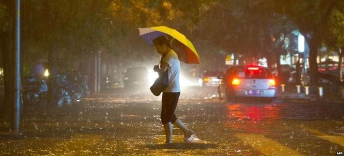
Municipal authorities are warning residents to be wary of flooding as a severe convection thunderstorm is expected to strike Beijing today.
A severe thunderstorm forecast for Thursday will last all day long. Rainfall accumulation is forecast to hit up to 80 millimeters in the city with as much as 50 millimeters expected to fall in one hour alone during peak precipitation. Besides lightning, the storm will bring sporadic strong winds and hail.
Described as being long in duration and wide in area, the “worst storm in six years” is expected to break local weather records.

The rain warning for the Beijing, Tianjin, and Hebei areas have begun yesterday evening with scattered showers and finally subside by Saturday when heavy rains will taper off, continuing in scattered light showers right up until Sunday.
The local weather department is warning residents to be on alert for flash floods, landslides, mudslides, and small river floods. Along the same lines, people are specifically warned to stay away from the city’s mountainous areas, which have already experienced flood conditions this past week.
Info circulating on Chinese social media describes the oncoming storm as having “category 10 winds” and being a “super torrential downpour.” However, chief forecaster for the national weather department Fang Chong debunks these rumors, saying that only category 6-8 winds are expected instead of “gale winds” and that rainfall will be heavy but not massive.
Severe weather has struck Beijing before with fatal results. Seventy-seven people died in flash floods when heavy rains hit the city on July 21, 2012.
READ: One Year Later: Safety Tips for Flash Floods
All the same, the term “flooding” isn’t one that has been commonly cited in the Chinese media. While a yellow rainstorm alert had been rescinded, we can only hope that the 2013 improvements made to Beijing’s flood control system would hold out. And yet, things don’t look good when flooding the very next year forced drivers to flee 15 vehicles in the suburb of Yanjiao.
We urge everyone to stay safe, and follow these handy tips:
- Avoid large puddles or other flooded areas. This seems like common sense, but too many people have attempted to cross areas of water on foot, bicycle, or car, only to discover the water was deeper than expected.
- Do not hesitate to leave a vehicle if in doubt.
- If water levels prevent the opening of a vehicle door, open the window and try to escape through it. If water levels are above the windows, the glass may need to be broken using the headrest to allow the car to flood – equalizing the water pressure inside and outside will likely assist escape.
Thursday’s thunderstorm is caused by a low-pressure area colliding with a humid jet stream, causing rising air to release moisture and form storm clouds. Due to its updrafts and downdrafts, convection thunderstorms pose a danger to air traffic, signifying that delays will be likely at Beijing Capital International Airport.
On the bright side of things, the storm will bring cooler temperatures to heat-stricken Beijing where nighttime lows will reach 19 degrees Celsius.
This post originally appeared on our sister site, the Beijinger. More stories from this author here.
Twitter: @Sinopath


